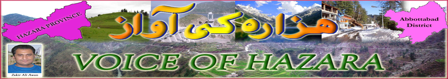

HAZARA PROVINCE:
 Hazara is a newly announced province of Pakistan. In 2010 it was announced that the name of the province would be changed from “North-West Frontier Province” to “Khyber Pakhtoonkhwa” which led to protests across the Hazara region to form a new separate Province. Until the year 2000 the region was an administrative subdivision of the province known as Hazara Division, headquartered at the city of Abbottabad. Hazara Division was the biggest division of Khyber Pakhtoonkhwa. However, the divisions were abolished in 2000, as part of an administrative shake up. Although the administrative division has been abolished by the government, the identity and name have been retained and used for other purposes. For example, the University of Hazara, based in Mansehra, provides higher education to people of the region. The election commission of Pakistan also groups the districts of Pakistan under the former divisions. Six districts make up Hazara; these are Abbottabad, Battagram, Haripur, Kohistan, Mansehra and Torghar (the Torghar got the status of district in June 2010, the Khyber-PK administration had taken this step to avert the pressure of Tehreek-e-Sooba Hazara and trying to divide the Hazara Community on ethnic basis).
Hazara is the heart of NWFP with the maximum economic and cultural contribution of the income of NWFP. Hazara produces 70 percent tea of total production of Pakistan and Hazara also produces the 100 percent Tobacco for Pakistan. Tarbela Dam is also located in Hazara from where the government of Pakistan has produces 39 percent from the total electricity production in the country. A rare and very expensive kind of fishes namely Trout are also available in Hazara beautiful “Kunhar” river and all three lakes.
DISTRICT ABBOTTABAD:
Abbottabad is a district in the Hazara Province of Pakistan. The district covers an area of 1,969 km with the city of Abbottabad. The district is named after Major James Abbott, the first deputy commissioner of Hazara (1849 – 1853).
According to the 1998 census of Pakistan the population of the district was 0.88 million – and according to an estimate this had risen to 1.05 million in 2008. The main tribes are the Dhund Abbasies, Tanolis, Awans,Rajputs, Jadoons,Kashmiri, Maliar, Dhanyal, Sarrara, Qureshis, Karlals, Sheikhs, and the Syeds.
Miranjani (3,313m) and Mukeshpuri are the highest peaks in Nathia Gali in this district.
Under the NWFP Wildlife (Protection, Preservation, Conservation and Management) Act of 1975, two areas have been designated with the district: Ayubia National Park and Qalanderabad game reserve. Both areas cover only 6% of the landed area of the district.
Ayubia National Park established in 1984, this park covers an area of over 3,312 ha, while Qalanderabad game reserve established in 1980 with an area of 8,940ha.
Some of the minerals mined within the district are barite, dolomite, granite, gypsum, limestone, magnetite, marble, and phosphate, red ochre and red oxide.
DISTRICT MANSEHRA:
 Mansehra District is an administrative district within Pakistan’s Hazara Province covering an area of 4,579 sq.kilometres; it had a population of 1,152,839 at the 1998 Census. A popular tourist destination Kaghan Vally in Pakistan situated in the district and Karakoram Highway also passes through the district.
Mansehra is two hours away from Peshawar and three hours away from Islamabad. It is closely linked to Afghanistan in the west, which has increased the number of Afghan refugees in Mansehra over the past years.
The district of Mansehra has been blessed with wonderful scenery. Some of Mansehra’s main features are mountain ranges, plains, valleys, and numerous lakes and rivers.
 There are three lakes in the district: Lulusar Lake, Dudipatsar Lake and Saiful Muluk Lake. All three are located in the beautiful Kaghan Valley and act as a mirror reflecting the snow-clad mountains surrounding them.
Lulusar Lake is approximately 48 kilometres away from Naran and has an altitude of 3325 meters. Surrounded by wildflowers in almost all colours imaginable, this lake is the main source for the Kunhar River. Lake Lulusar is said to be one of the most tranquil spots on the Kaghan Valley, the lake is fenced by snowcapped mountains whose image is reflected on the standstill blue-green waters of the lake.
Dudipat Lake is enclosed with beautiful, high, snow-drizzled peaks, it is one of the hardest places to reach, requiring a tough hike lasting four to seven hours. The hike is rewarding, as tourists are greeted with green pastures and the lake’s blue-green waters.
The most famous of the district’s many lakes is Lake Saiful Muluk, named in a folktale—the Qissa Saiful Muluk—about a romance between a Persian prince and a fairy princess. In the folktale, the lake was the meeting site for the two lovers. Lake Saiful Muluk is located at the northern end of the Kaghan valley. At an altitude of 10,578 feet (3,224 m) above sea level, it is one of the highest lakes in Pakistan. The water is spectacularly clear with a slight green tone. It is accessible by a jeep road during the summer months or can be hiked up from the village below in four to six hours. The clarity of the water comes from the multiple glaciers all around the high basin feeding the lake.
Mansehra is considered a good place for education because of its natural beauty and climate, it is the location of Hazara University and also contains colleges and many good schools. The First primary school in the district was established in 1872 in Behali village. Almost at the same time in Baffa and in 1892 in Mansehra city.
DISTRICT HARIPUR:
 Haripur is both a city and a district in the Hazara Province of Pakistan. Haripur District has the highest Human Development Index of all districts in the NWFP. Haripur District is situated about 610 meters above the sea level.
Haripur’s population was 692,228 at the 1998 Census, but was estimated to be 803,000 in 2005. Out of those only 12.0% of the population live in urban areas, while, the rest (88.0%) of the population lives in the rural areas.
The population is spread over 1,725 km², with population density of 401.3 persons per km², this compares to the average population density of 233 persons per km², in the North West Frontier as whole. The average household size of the district is 6.6 persons per household compared to 8 at the provincial level. Agriculture is the livelihood of the rural population; the total arable area is 77,370 acres (313.1 km²).
According to the 1998 District Census Report, Hindko is the predominant language in the district, representing 70% of the total population. Other languages spoken are Gojri,Potohari, Pashto and Pahaari.
The overall literacy rate for Haripur district is 53.7%, substantially higher than the provincial literacy rate in NWFP (35.2%). The female literacy rate is dismally low at 37.4% compared to male literacy of 63.6%. The urban: rural break down show that rural literacy is lower (51.4%) than urban literacy (69.7%).
DISTRICT BATTAGRAM:
 Battagram is a district of Hazara Province of Pakistan. The valley was ruled by Khans (tribal rulers) until 1949, when it signed the Instrument of Accession with Pakistan. In 1971 Tehsil Battagram was merged into Pakistan as an administrative part of the Battagram sub-division. In 1993 Battagram was upgraded to the status of a district. Before Battagram obtained the status of district, it was a Tehsil of the Mansehra District and Battagram become one of the sub-divisions of Battagram district.
It has a total land area of 1301 square kilometers and the estimated population of Battagram District in 2004-2005 was 361,000. The main language of the district is Pashto.
The area is mainly inhabited by Pathan tribes, the Swati, these people came from Swat and settled in Tehsil Battagram. The Swati has a good social status in the valley. The Pashtun tribes are divided in so many sub-tribes some famous of them are Younas Khel, Raza khani, Malkaal, Mula Khel, Khadar Khani and Shams khel Deshan,Qureshi (subtribe) shibzadgan” etc.The people are very hospitable. They have the small enmities of lands.Often they fought for the land but for last one decade the trend to fight for the land is finished. Often the people solve their problems with Jirga systemin villages different people are living.most of people living outside the country like Saudia Arabia, U.A.E., Qatar, America, United Kingdom.
Tehsil Battagram is bounded by Allai, Shngla and Kohistan on the north and east, by the Kaghan valley, and by Mansehra on the west. Tehsil Battagram is divided from Allai on the north by a range of mountains rising to over 15,000 feet, and from Mansehra by another range running from the Afghanistan border to the Indus above Thakot. The total area of Tehsil battagram is about 300 square miles(780 km²). Wheat, barley, corn and rice are grown, and the mountain slopes at the eastern end covered with forest. Cis-Indus Swati’s are the dominant tribes of the Tehsil Battagram. Khan culture is dominant in the Battagram Valley.
DISTRICT KOHISTAN:
 Kohistan has two distinct meanings in Pakistan. In Persian “koh” means “peak” and “istaan” means “land of”. In its usual modern sense Kohistan District is an administrative district within Pakistan’s Hazara Province covering an area of 7,492 sq.kilometres; it had a population of 472,570 at the 1998 Census. Kohistan District is divided into three Tehsils (subdivisions) including Palas, Pattan and Dassu. The capital of Kohistan is Dassu.
The River Indus flows through Kohistan and divides it socially and culturally. Kohistan is one of the least developed districts in the country and its national significance is the Karakurum Highway. This road is the main source of trade, transportation and link between Pakistan and China.
Kohistan is where the Hindukush, Karakuram and Himalayan mountains systems meet and serve as a natural boundary for environmental regions in the chains of the Himalayas, Karakoram and Hindu Kush mountains. This uniqueness of the mountains system also results in rich flora and fauna and therefore gives home to unique species such as the Western Tragopan pheasant and the Snow Leopard.
DISTRICT TORGHAR (KALA DHAKA):
 Torghar (Kala Dhaka) was the part of District Mansehra. In 2010 after renaming the NWFP province as Khyber-PK, the people of Hazara shown their resistance over the renaming of their province and after passing the new name in National Assembly and Sanate of Pakistan, the people of Hazara demanded for their separate Provinve Namely Hazara Province by starting protest demonstrations rallies and sit-in across the Hazara.
In this situation the Khybar-PK government strated propegenda that the Hazara province is not the demand of all districts of Hazara as this is the demand of only three districts of Hazara including Haripur, Abbottabad and Mansehara. The provincial government had decided to divide the people of Hazara into ethnic basis and inicially took the decision to divide the District Mansehra as Pukhtoon dominated area of District Mansehra (Kala Dhaka) declared as separate district of Hazara to avert the pressure of Tehreek-e-Sooba Hazara.
New District of Hazara, Kala Dhaka (historically known as the Black Mountain of Hazara, in Pashto it is known as Tor Ghar) is a mountain range and a tribal area, which was previously a part of Mansehra District on the north-western Hazara border of the Khyber Pakhtunkhwa of Pakistan.
It is bounded on the east by Agror and on the south by Tanawal, toward east it is bounded by Buner, On North East this area border with Batagram the range has a length of 25 to 30 miles from north to south and an elevation of 8,000 feet above sea level. This area has also been called as Chagharzai , because of adjoining Chagharzai Areas Of Buner District. Opposite to Kala Dhaka, across River Indus is District Shangla, mainly the area belonging to Tehsil Martung. The Indus washes its northern extremity and thence turns due south. Between the river and the crest of the range the western slopes are occupied by Yusufzai Pakhtoons. The rest of the range is held by Swatis tribal group of Pakhtoons. The Black Mountain forms a long, narrow ridge, with higher peaks at intervals and occasional deep passes. Highest peak is known as “Machay Sar” which is visible from Agror & other adjoining areas. Numerous spurs project from its sides, forming narrow gorges in which lie the villages of the tribes. The upper parts of the ridge and spurs are covered with thick forests of pine, oak, sycamore, horse-chestnut, and wild cherry; but the slopes are stony and barren.
 Thakot is on the Karakoram Highway and thus coming out of Kaladhaka Via Thakot is a much better route as compared to choosing the Darband Route. The Karakoram Highway is in a much better shape from Thakot down to Abbottabad. The Road that traverses through Kala Dhaka keeps in touch with the Left bank of River Indus almost throughout its course.
Major Tribes of Tor Ghar (Kala Dhaka) are Akazai, Basi khel, Nusrat khel, Mada khel and Hssanzai or hasanzai.
Khyber-PK government allocated Rs 4 billion for construction of infrastructure of newly declared Tor Ghar district, while A tug-of-war is going on between the five tribes of the newly declared Torghar district over the selection of a suitable place for the headquarters of the erstwhile Kala Dhaka semi-tribal region. A jirga of Basikhel and Nasratkhel tribes with Khyber-PK Minister for Haj Namroz Khan, demanded that Judbah Town be made the headquarters of Torghar district. The jirga included on Luqman Shah, Abdullah Khan, Zafarullah Khan, Zahir Shah, Mohammad Zahid, Fazal Azeem and other elders said that Judbah as headquarters would be easily accessible to all five tribes.
Demographics
The population of Hazara is more than 6 million with a total area of 18013 km2. The Hazarawals are not extremists and conservatives. They have the most realistic literacy rate of 94 percent.

Agagr mera Lahoo B mango ge SOBA HAZARA Kay lea tu mein 100 bar marny ko tayar hun i love Hazara
Sajjad Tanoli
G A Asanda
Hazara Qomi Jirga
G A
WAQAR SHAH BHAI
very good website. Many many thanks for the efforts. All hazarawals afghan muhajiro ko hazara say nikalo.
Assalm-o-Alaikum;
First of all I want to appreciate heartly your this sort of hard work for our beatiful land.
Undoubetedly, The Sooba Hazara Insha Allah will be formed soon (but as you mantioned on your website with the word Province that is wrong because if i speak frankly and openly we people are very happy what we have but we are not struggling to preserve what we have).
I want to leave some suggestion to improve your website as given under;
1. The District of our Hazara now 6 (newest is Torghar=Kala Dhaka)
2. Kindly full detail of District Battagram ( specially hindko speaking people as most of the reader want to know about all the districts of Hazara)
I hope you will appreciate my suggestions and I am waiting to hearing from you.
Best Regards,
Mohammad Rizwan Ashraf
Mansehra Colony, Landhi, Karachi
Rizwan main v Rizwan e aan, tusaN ny Bhaon changi gal aakhi ay, asaN hoslay nal km kinra paisi
salam garm taqdeem hazarahai daler …….
i am mohammad naseem and i live currently in QUETTA ….. when i fine this website so i realy became happy ……. that hazara has SOOBAH and realy i am realy glad ……………….. good luck with ur Website ………………………..
waqe badzat badzat hi huteen in loogoo ko bat karny ki tameez nahi hote hy .is ly k bynasal hooteen heen ur bi bunyad bateen karny laqteen heen ur jab pakhtoon ka chmat lagta hy pir boolteen heen y kitny naqara loog heen lihaza pakhtoono k gazb sy daro pata nahi kis waqat pakhtoono ka damag goom jay ur pir pakistan meen kisi bi koony meen bi jaga na ho sar chopany ka .jy .pakhtoonkhwa
good effort,can u provide me the details of races and tribes of Abbottabad,especially of Banda Khair Ali Khan????????
Hazara will become a province Insha-Allah. if u have power than stop us to create Sooba Hazara . you bloody khan bahadur
G.A HINDKO , G.A HINDKI’S . G.A HAZARA , G.A HAZAR-E-WALL.
Apni Zameen , Apni Zaban . We want SOOBAH HAZARA
I like to solute to the owner of this page best of luck to you and your team keep it up. G.A HAZARA G.A HAZAREYWALL’S
I was examining some of your posts on this website and I believe this website is really instructive! Keep on posting .
Enjoyed studying this, very good stuff, thankyou . “Success doesn’t come to you…you go to it.” by Marva Collins.
Youre so cool! I dont suppose Ive read anything like this before. So nice to find somebody with some original thoughts on this subject. realy thank you for starting this up. this website is something that is needed on the web, someone with a little originality. useful job for bringing something new to the internet!
Hello.This article was really motivating, particularly because I was searching for thoughts on this issue last Monday.
HAZARA. .IEK PUKHTOON JARNEEL NAY IEK HAZAR 1000 SEPAHEO K SAAT HAZARA MEEN QEYAM KIA 1000 SY HAZARA K NAAM SY YAD KIA GIA UR NAAM HAZARA HOGIYA HY
HAZARA MEEN 80/. PUKHTOON .QOOM ABAAD HY 20/. DEGAR LOOG REHTEEN HEEN UN MEEN SAY KUCH BY NASL PUNJABI K ALLAKAR HEEN UR PUNJAB KI BATEEN KARTEEN HEEN K PUNJAB PUKHTOONKHWA K DEEMOO PAR QABZA KARLEEN JU QIAMAT TAK MUMKIN NAHI HY IS PUNJABIU NY AADA PAKISTAN KUIA HY Y BEGERAT KIA PUKHTOONO K IRYA PAR QABZA KARLEEN GEEN
IEK PUNJABI TATTOO NAY LIKKA HY AFGAN KO NIKAL DO’ WAY BINASLA ALL PAKHTOON AFGHAN HY UR Y AFGHANO K SUBY KA HISSA HY
HINDKO ZABAN / KA APNA BUNYADE KWE HASEYAD NAHI HY UR KISE QOOM KA ZABAN BI NAHI HY HINDKO MEEN ZEYADA PUNJABI UR KAM KASHMEERE ZABAN KA PALOODA HY UR DOONO QOOMEEN GEERAT MEEN BI ZIADA MAQBOOL HEEN
IS LY .PAKHTOO ,PAKHTOON . PAKHTOONKHWA ZENDABAD